HIGHFIRE RISK PROJECT

FIRE CHANNELLING EVENTS

DateFireLocationLongitude (d.dd°)Latitude (d.dd°)Elevation (m)TypeCode
7th Feb 2009East Kilmore FireKilmore Gap, Vic145.02-37.28400L090207A


This fire started west of the Hume Highway and near the town of Kilmore. With a wind direction of 330° grid the fire started travelling to the east. However, the mapping shows clearly that the fire also moved to the west southwest in the lee of a hill.
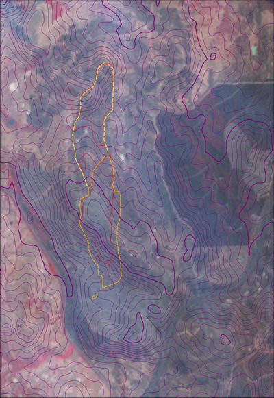
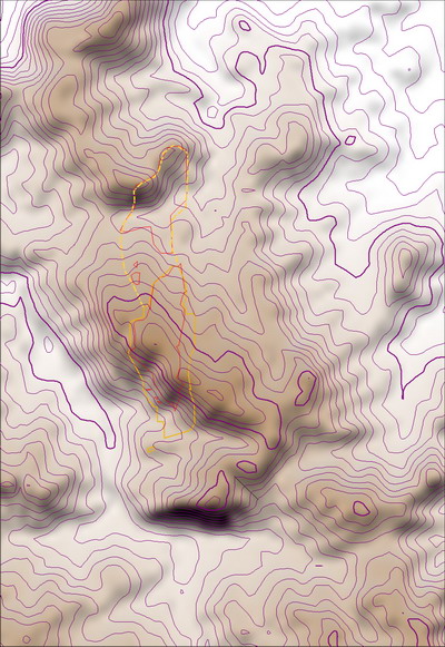
While this event does not have a strong right-angle bend in its perimeter, the alignment of the fire with the terrain shows that channelling was involved almost immediately after ignition.


Fire Channelling edges overlaid on DEM showing precise terrain alignment.
Channelling fire edges overlaid on ASTER image taken shortly after the fire.
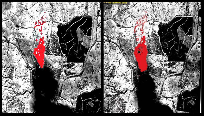
Note that the fire direction scars in the pine forest to the east show that fire travelled through it to the southeast. This strongly suggests that non-channelled fire runs occured after the linescans were flown.

The map material is from a report of the NSW National Parks and Wildlife Service. The model data is from Geoscience Australia and the Shuttle Radar Terrain Mission. ASTER imagery from NASA.