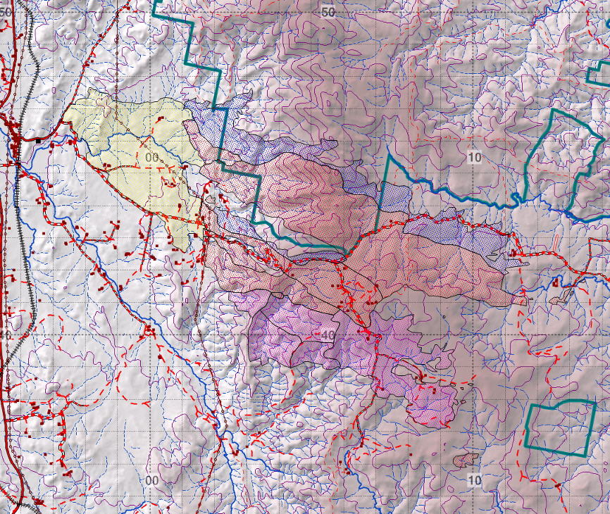
| This fire started under catastrophic fire danger conditions. It started adjacent to an unsealed road near Michelago. After crossing an expanse of grazing lands (yellow) it climbed up the escarpment of the Tindery Ranges (orange). It then entered the scattered properties on the tablelands behind the ranges. The left flank expanded after a SW wind change (blue) while the south flank was expanded by channelling (purple).
| 
|
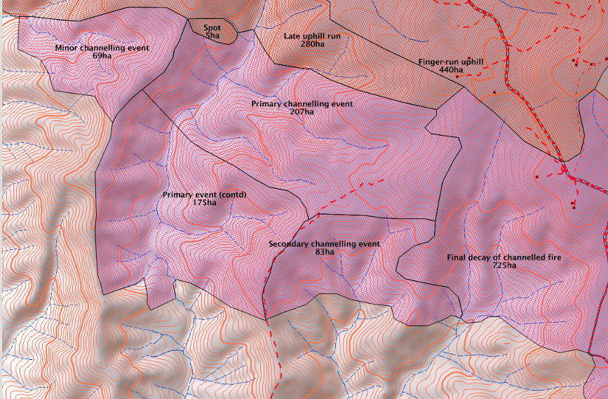
| Detail of the channelling affected fire areas on the south flank.
| 
|
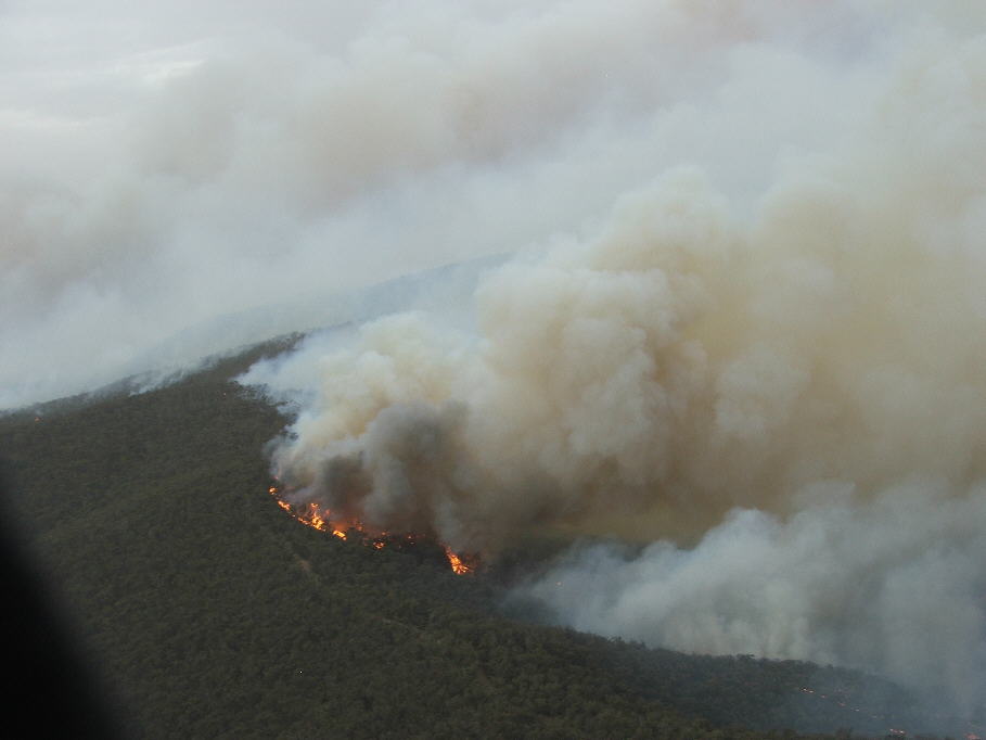
| Photo of the upwind edge of the fire channelling event in the gully, looking to the NNE across the prevailling winds. Note the plume colour and the spot fires downwind.
| 
|
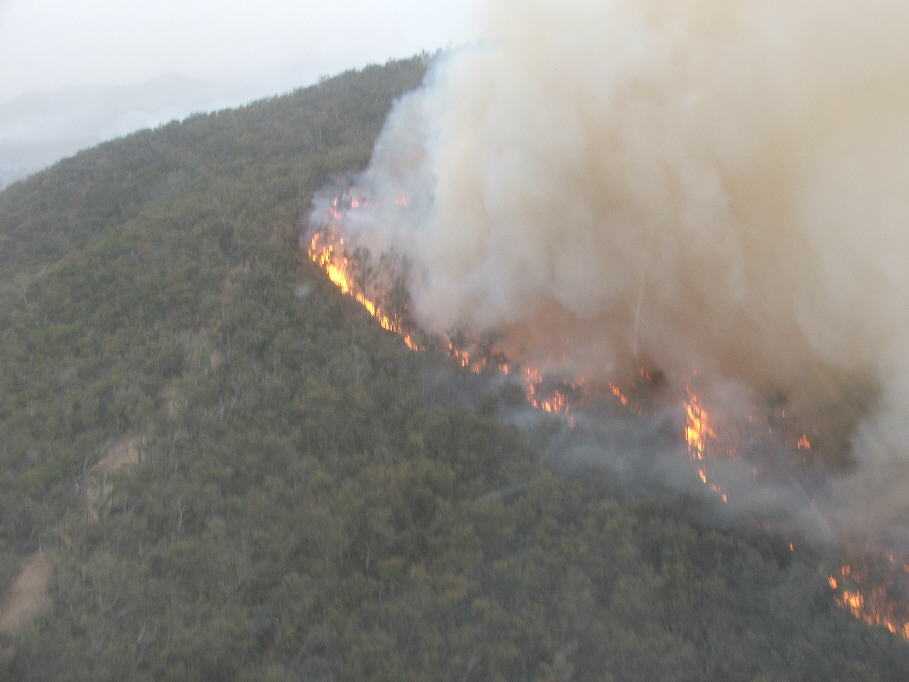
| Detail showing the rapidly coalescing spotfires on the advancing lateral edge of the event. Note that activity near the ground is advancing upslope to the left, while the plume (laden with embers) is advancing to the right and towards the camera.
| 
|