HIGHFIRE RISK PROJECT

FIRE CHANNELLING EVENTS

DateFireLocationLongitude (d.dd°)Latitude (d.dd°)Elevation (m)TypeCode
16 Dec 1977Lawson FireLawson, NSW150.43-33.71720V771216A


This fire started north of the Great Western Highway and west of the town of Lawson in the Blue Mountains. With a wind direction of 255° grid the fire started travelling to the east. However, the mapping shows clearly that the fire also moved to the north along a gully line.
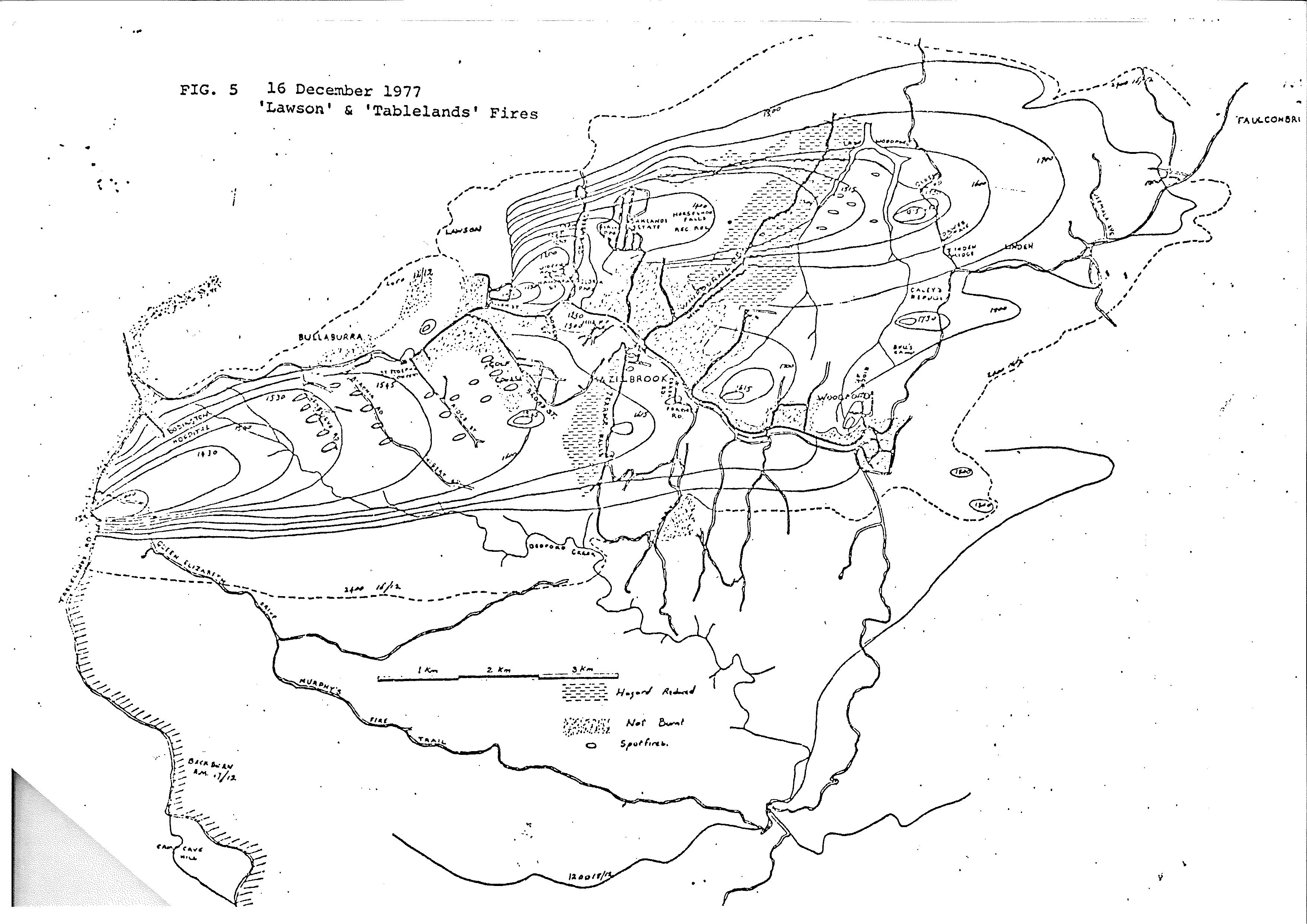
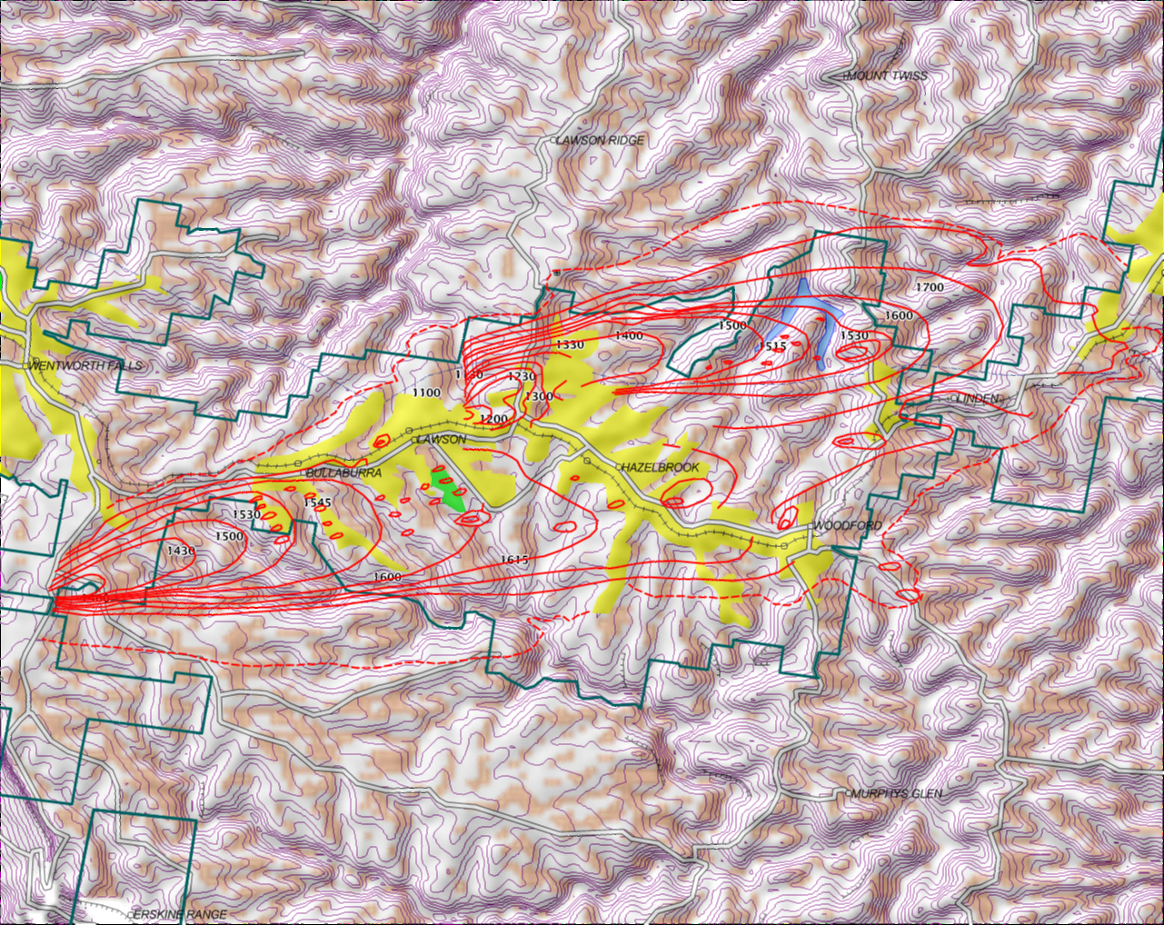
Note that there was a second fire coming off the Kings Tableland, south of the highway.
The main feature to note is the marked right-angle bend in the rear of the left flank of the fire, in the gully. This is a diagnostic feature of fire channelling. Note also that there was intense spotting downwind of this.

Click for full size

In this digitised rendering, the beige colour on the digital terrain model is output from a model of sites prone to fire channelling under the prevailling winds. It is seen that, allowing from issues with hand-drawn fire maps from the 70s, the lateral spread on the left flank coincides with a deep valley.
Click for full size


The map material is from a report of the NSW National Parks and Wildlife Service. The model data is from Geosceince Australia and the Shuttle Radar Terrain Mission.