HIGHFIRE RISK PROJECT

FIRE CHANNELLING EVENTS

DateLocationLongitude (d.dd°)Latitude (d.dd°)Elevation (m)TypeCode
26 Jan 2003 Dead Horse Gap148.35 -36.53 1500 V030126H

This fire was part of the south-eastern expansion of the main Kosciuszko fires after they had been burning for 18 days. It is in NSW, and within Kosciuszko National Park. It is on the edge of the alpine plateau south of Dead Horse Gap and east of the main drop-off down to the Indi River (the head of the Murray River).
Starting around Tom Groggin Station on the Victorian border, an extreme fire event burnt through much of the valley to the south, easing as it reached the plateau edge on its southeast edge. A customs plane equipped with a FLIR pod overflew a fire channelling event at the nick point for Cascade Creek. This shows all of the required features, and was captured in video footage.
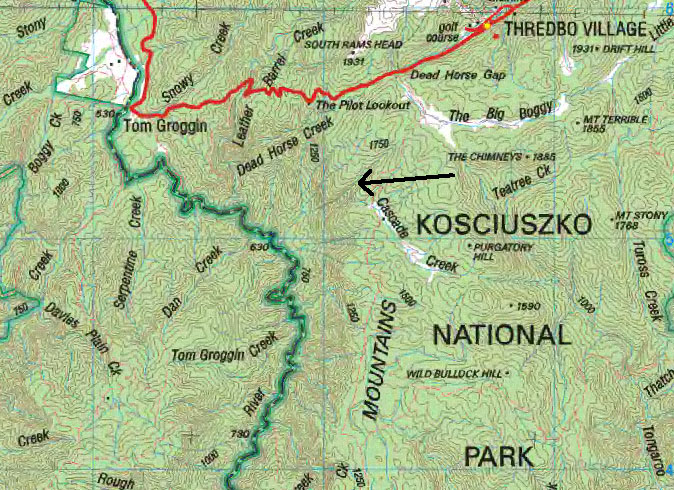
Map of the area, with the arrow showing the base of the main plume, and the direction of approach of the aircraft. (Data: Geoscience Australia)
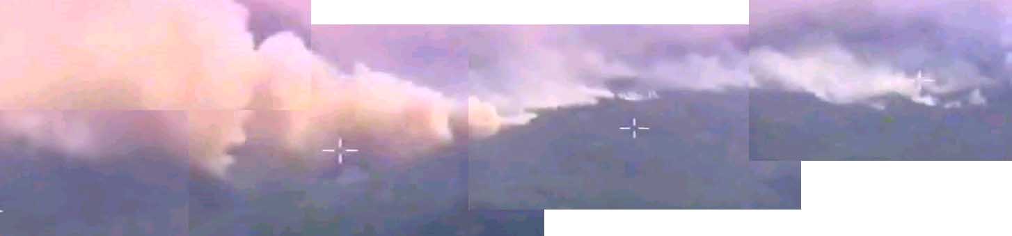
This mosaic is taken from frames if the FLIR video of the event. Visible in the background is the smoke-filled Indi Valley, with the unburnt alpine plateau in the foreground.
Note that as expected this fire flank, on a major reduction in slope, is not of extreme intensity. However, at the nickpoint of Cascade Creek (GR 110 520, in the centre of the image) there is a hillside able to produce fire channelling under that day's weather.

Click for full size.
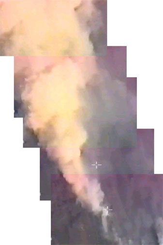
This second mosaic is also taken from frames if the FLIR video of the event, and is looking almost directly down onto the main plume. Visible on the right is the smoke-filled Indi Valley, with the unburnt alpine plateau to the left.
Note the rapid expansion of the plume as it rises - indicating a hot fire - and its diagnostic colour.

Click for full size.
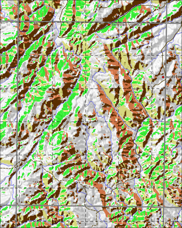
This is the fire channelling model output for that area. (See GR 110 520)


This material is from video taken during an aerial reconnaissance mission flown by Australian Customs for the ACT Bushfire Service. The multispectral linescans were flown by Air Target Services Pty Ltd for the NSW Rural Fire Service. Terrain model and contours are derived from Shuttle Radar Terrain Mission data.