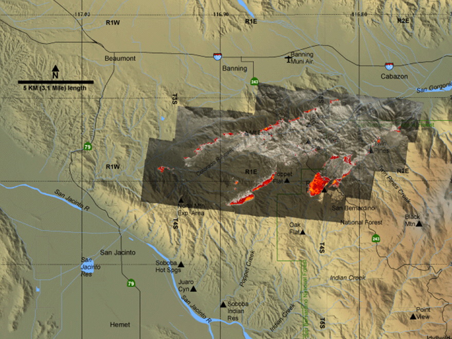
This fatality fire burned over a range of hills to the NW of San Jacinto in California. Linescans flown while it was traversing that range clearly show lee-slope fire channelling affecting the fires spread.
|
|
| Google Earth view to NNE towards origin of fire. Note the marked step in the flank in the lee of the spurline running towards the lower right. | 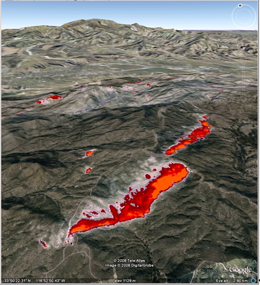
|
| Google Earth view of the first scene with two linescans superimposed to highlight the lateral spread of the fire where it is affected by channelling. Note in the lower left quadrant of the scene there are two distinct flaming zones, but that the second is displaced to the SE, while the fire winds are blowing to the SW. | 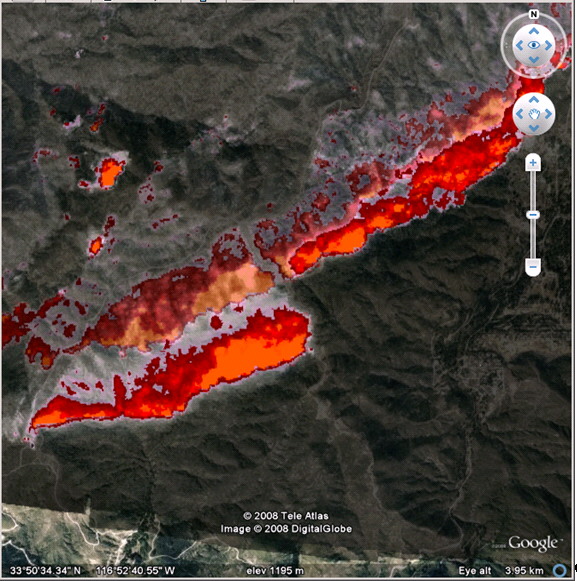
|
| Google Earth view to WSW showing deep flaming occuring in a lee-slope fire channelling driven breakaway. The first scene is visible in the far distance. | 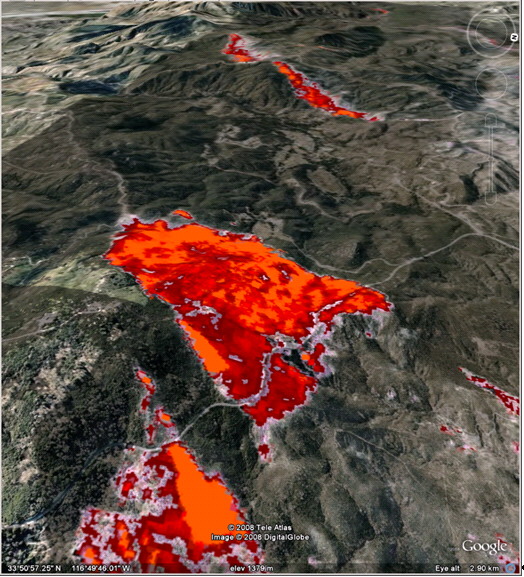
|