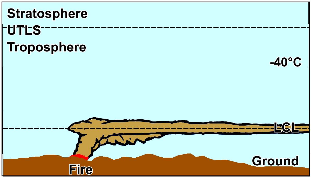
Type S1: Smoke shield
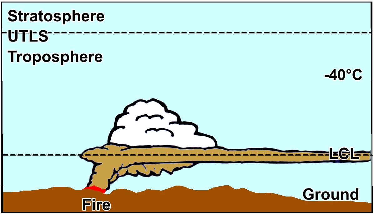
Type S2: Smoke shield with rebound
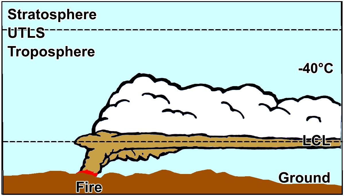
Type S3: Smoke shield with towering pyroCb
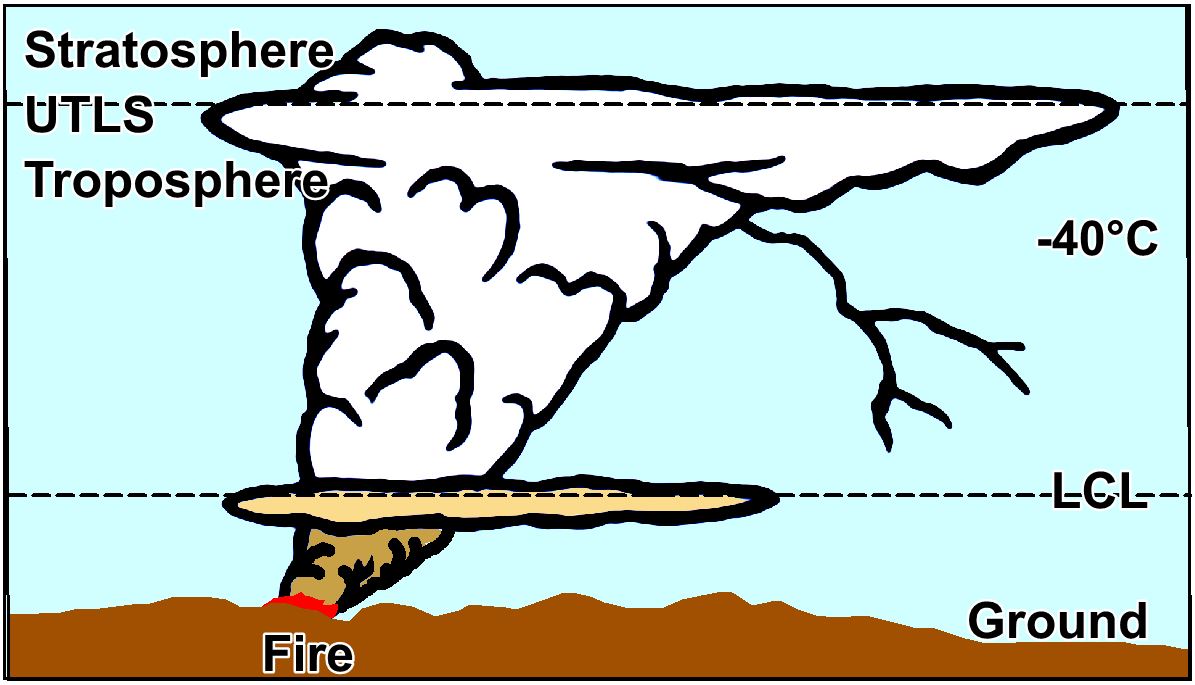
Type U1: Sub_UTLS event
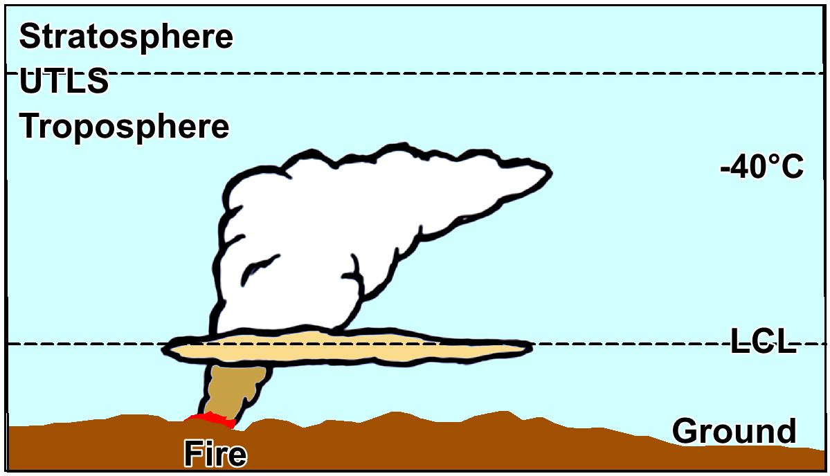
Type U2: PyroCb
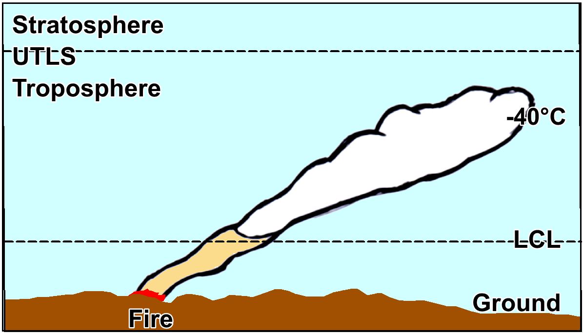
Type U3: Pyro-puff (towering pyroCu)
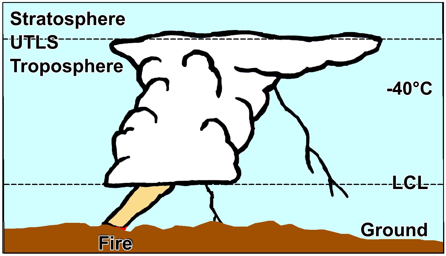
Type U4: Fire enhanced ambient Cb event
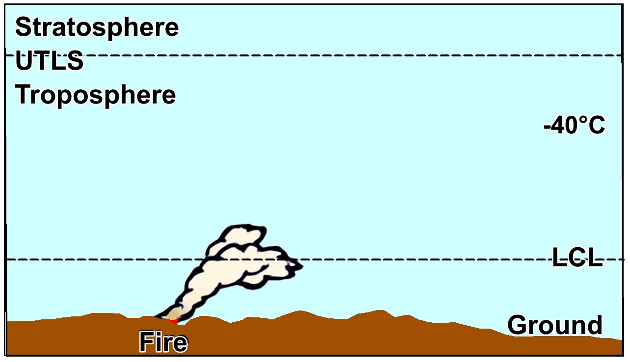
Non-VPC fire
DEFINITION: VIOLENT PYRO-CONVECTION (VPC)A fire’s local shape and intensity determines the local behaviour of the smoke plume above it. Very low intensity produces sluggish, white, wispy smoke that rapidly mixes out with the surrounding air. As intensity increases, the smoke gains in density and persists longer, while rising, before mixing out. As defined by Brian Potter, there are a series of stages as a plume builds. Here we will look at two end stages. Both correspond to BUFEs and deep flaming.VPC Scenario 1. At very high intensities, the plume resists mixing out as it rises, and punches out of the mixed layer. The plume rises well above the top of that layer (the Lifted Condensation Level, LCL, or cloud base), above which there will be a pyrocloud within the plume. This is often termed a plume-dominated fire. The atmospheric profile is unstable. VPC Scenario 2. At very high intensities, the plume is trapped below a low-level inversion and moves downwind under that cap. Typically the only pyrocloud that forms is localised pyroCu or towering pyroCu. The atmospheric profile is stable. |
| The following types of violent pyro-convection are covered here: | |
Unstable (Scenario 1) | |
| PyroCbs | Type U1. PyroCb (no context) |
| Type U1a. PyroCb event | |
| Type U1b. PyroCb cluster | |
| Type U1c. PyroCb Pulse | |
| Type U1d. PyroCb outbreak | |
| Type U1e. PyroCb super outbreak | |
| Non-pyroCb events Type U2. Sub-UTLS event | |
| Type U3. Pyro-puff (isolated towering pyro-Cu) | |
| Type U4. Fire-enhanced ambient Cb | |
Stable (Scenario 2) | |
| Type S1. Smoke shield | |
| Type S2. Smoke shield with rebound | |
| Type S3. Smoke shield with towering pyroCu |
|
Type S1: Smoke shield |
Type S2: Smoke shield with rebound |
|
Type S3: Smoke shield with towering pyroCb |
Type U1: Sub_UTLS event |
|
Type U2: PyroCb |
Type U3: Pyro-puff (towering pyroCu) |
|
Type U4: Fire enhanced ambient Cb event |
Non-VPC fire |
Normal fire (No VPC)If the convective cap is moderate – broadly between 4°C and 6°C – the plumes of these fires mix out rapidly as they rise, do not couple with the air above, and do not form VPC. Cu clouds are often present but have no impact on fire dynamics |
|
Type S1. Smoke shieldIf the profile is very stable, with an intense convective cap (over 10°C), there is likely to be no pyrocloud. This is because the plume cannot pass the cap, and spreads out sideways as it advects away from the fire. There can be some immediate gravity-driven downwash of large aerosol and perhaps firebrands in the immediate lee of the main plume. |
|
Type S2. Smoke shield with reboundIf the profile has a very strong convective cap, between roughly 8° to 10°C, short-lived towering pyroCu are likely to be present. Overall, the plume cannot pass the cap, but its core does initially push past, forming a towering pyroCu. Once initial upward momentum and the effect of latent heat of condensation dissipates this subsides back to the smoke shield, with the cloud evaporating. After that, the plume spreads out sideways as it advects away from the fire. There are indications of the potential for a downburst, not necessarily aligned with the prevailing winds (rather reflecting the balance between the wind vectors and outwards plume spread vectors). There can be some immediate downwash of large aerosol.A key safety concern arises if the fire is on high ground, closer to the LCL, as the downburst can rapidly push fire downslope, with the potential to cross containment efforts. |
|
Type S3. Smoke shield with towering pyroCuIf the profile has a strong convective cap, between roughly 6° to 8°C, then persistent towering pyroCu are likely to be present. The plume cannot pass the cap, except in its core which pushes past, forming a towering pyroCu. Once initial upward momentum and the effects of latent heat of condensation dissipate this persists for some time. The rest of the plume also spreads out sideways as it advects away from the fire. There can be some immediate downwash of large aerosol. |
|
PYROCB description:A pyroCb is a cloud that forms in a rising fire plume (convection column) and has all of the following properties: (1) reaching the UTLS; (2) Cb morphology, including an anvil, sometimes an overshooting top; (3) often a cauliform texture to the basal parts; (4) glaciation (and perhaps subsequent lightning generation) when average cloud-top BT falls below -40°C; and (5) an unambiguous linkage to convection immediately above the fire. The duration of the source BUFE exceeds the time taken to reach the UTLS, so the anvil is clearly linked to the fire. The fire needs to form deep flaming under an unstable profile. These fires often spread by dense short and medium range spotting, and are thus poorly held (if at all) by most containment options (even with no fuel for 1.5 km ahead of the fire). They present significant safety risks for fire crews, especially if the occurrence of dense spotting is neither forecast nor detected.The pyroCb event may emerge from only a localised part of the fire’s extent – the rest must not be overlooked. PyroCbs reach the UTLS, and the resulting plume cloud has an anomalous Brightness Temperature Difference (BTD) (i.e., 3.0 μm BT – 10.3 μm BT exceeding 50°C) due to the aerosol within it. Reaching the UTLS guarantees glaciation and lightning. Strong convection creates indraft winds that dominate fire behaviour. On reaching the LCL, the condensation of water vapour (from indrafts and from combustion) releases latent heat of condensation, which may be up to three times the heat from the fire. This enhances convection. For a large range of altitudes the plume will be thermally expanding, and thus resisting mixing out. This often gives the plume a cauliform appearance. The radiant heat from the fire causes radiative forcing of the aerosol-filled plume. Airborne infrared imagery above the BUFE shows reflection, scattering and re-radiation underway for up to 2 km above the fire. This aids thermal expansion within the plume. PyroCbs can often occur nocturnally, if the fire’s energy release can negate the nocturnal inversion. Mixing down of dry air aloft or nocturnal low-level jets can be involved, as can burn-out ignition patterns. PyroCbs or Cbs appear to be able to be initiated when a passing atmospheric disturbance such as a soliton or a derecho disrupts the convective cap. These are uncommon and not well known, and future instances need to be studied. A fire that creates a pyroCb: radically changes winds around the fire edge; impedes situational awareness; creates major vorticity events; causes low oxygen combustion; and, as a result, creates ember storms. All of these are dangerous for fire crews. Pyrogenic lightning may cause new ignitions downwind (based on upper steering winds, not surface winds). It is important to note that pyroCbs involve very small water droplets, due to smoke provide many nucleation particles. As a result downburst events are not expected. It is feasible that a fire-enhanced Cb (U4) could produce a downburst – covered by normal fire ground safety alerts for Cbs. |
Type U1. PyroCbThere is a need for a range of terms to describe pyroCbs.If it is a poorly understood event lacking contextual details, for instance if a pyroCb is reported with no extra information, it is called a pyroCb. However, due to the varying impacts on fire behaviour and fire crew safety that such events signify, it is desirable to, if possible, further classify pyroCbs, below. Sometimes there will be insufficient information to do so (especially with forecasts or with retrospective analyses) or the Incident Management Team lacks the capability or resources to further classify the event. If in near real-time, the affected Division should be treated as dangerous for fire crews for, nominally, three hours, with continuing re-assessment of the fire-ground risk profile. |
|
Type U1a. PyroCb eventA pyroCb can occur when VPC production originates from a limited area, typically less than 50km, linked to a single or multiple overlapping BUFEs.This is likely to be from a single fire or fire complex, and likely from a single Division. After initiation, the BUFE typically lasts for up to three hours. The affected Division should be treated as dangerous for fire crews for, nominally, three hours, with continuing re-assessment of the fire-ground risk profile. |
Type U1b. PyroCb clusterHere VPC initiation spans a broader area, typically involving multiple fires in a limited area, a fire complex, or more than, indicatively, 50km across a fire-affected area. VPC production does not exceed the lifetime of the underlying BUFE event, typically 2 to 3 hours.On a landscape with multiple fires, or fire complexes, conditions amenable to BUFEs may occur nearly simultaneously on more than one fire. This reflects the spacing of fires across the landscape, and often shows passage of a trough, wind change event, or the sudden removal of a convective cap (such as by the removal of dense smoke by a wind change). All sectors and divisions of all fires involved should be treated as dangerous for fire crews for a minimum of three hours, with continuing re-assessment of the fire-ground risk profile. Affected and nearby Incident Management Teams need to coordinate their assessments. |
Type U1c. PyroCb PulseHere VPC production originates from a limited area, typically a single fire, part of a fire complex or a span of less than, indicatively, 50km in a fire-affected area. VPC production exceeds the lifetime of a typical BUFE event, typically 2 to 3 hours. (This does not apply if the underlying fire significantly abates.)A dangerous fire can produce a series of pyroCbs from a common source area, the extent of which reflects the rate of expansion of the fire. The cause of this “cycling” has proven difficult to ascertain, but may be due to terrain patterns or to unstable feedback loops between the fire and its environment. Some or all pulses are pyroCbs, some may be Sub-UTLS events. Pulses act to extend the window of dangerous conditions beyond those of single pyroCb events – perhaps for an entire shift – requiring continuing re-assessment of the fire-ground risk profile. |
Type U1d. PyroCb outbreakHere VPC initiation spans between, indicatively, 50 km to 200km typically involving multiple fires in a limited area (often a fire complex) or less than 24 hours. An outbreak of pyroCbs involves a series of pulses from a cluster (i.e. spanning more than the duration of a typical BUFE, 2 to 3 hours, and more than 50km). General fire intensity does not abate for that duration. Not all events in a cluster need to pulse.All sectors and divisions of all fires involved should be continually re-assessed for danger to fire crews, with changes to incident objectives implemented as and when required. |
Type U1e. PyroCb super outbreakHere VPC initiation spans more than, indicatively, 200km and one day. This somewhat arbitrary term has been applied to a single event (in southeast Australia between 28 December 2019 and 4 January 2020) when regional conditions amenable to large numbers of BUFEs occurred over a number of days. This was associated with branched inshore troughs ahead of a stalled cold front. A long-lived low-pressure recirculation formed, keeping fire behaviour elevated.All sectors and divisions of all fires involved should be continually re-assessed for danger to fire crews, with changes to incident objectives implemented as and when required. This need carries over between shift cycles. The conditions involved mandate specialist meteorology advice, a specialist intelligence cell, and a dedicated remote sensing group. It is expected that future events (under the influence of climate change) could radically alter this definition. |
Type U2. Sub-UTLS eventWithin this group, there is one outlier: if there is an inversion between LCL and UTLS, significant towering pyroCu may occur. While outwardly resembling a pyroCb, these do not reach the altitudes required to qualify as a pyroCb – the cloudtop temperatures may not fall below -40°C, inhibiting in-cloud glaciation and lightning. The stronger the upper-level cap, the more the plume-top can visually resemble a pyroCb’s anvil.There can be interaction between fire weather and the plume, especially if the plume top is at high altitude, allowing strong convective dynamics near the fireground. |
|
Type U3. Pyro-puff (isolated towering pyro-Cu)If one of more fire Sectors make hot uphill runs, causing mixing down of dry air aloft, increasing fire intensity during the run, a short-lived form of VPC may occur. The resulting feedback does not persist when the uphill run ends. Potentially, burn-out ignition patterns could be involved, via a high isoperimetric ratio (the ratio of a fire’s basal perimeter to its area). If this is possible, then such ignitions should be halted immediately. Short-lived (under 30 minutes generation time above fire) towering pyroCu, minimum average cloud-top temperature typically above -40°C.The duration of core plume generation is less than the time taken for the plume to reach maximum altitude. Normal fire ground safety protocols should apply during such hot uphill runs, with monitoring for enhanced feedback developing. |
|
Type U4. Fire-enhanced ambient CbIf Cbs occur, or are about to occur within (typically) 50km of the fire ground, the smoke plume can then be entrained into a Cb’s inflow.BUFEs are commonly linked to trough lines, as are Cbs – so it is not unexpected that in some cases there is an ambiguity between a Cb or pyroCb label. Evidence suggests that North American pyroCbs occur preferentially in conditions conducive to Cbs, whereas there is no evidence for this in Australia. Ambient Cbs lack the abundant condensation nuclei that make pyroCbs so distinctive. Satellite imagery can help distinguish them – if the anvil has a cloud-top infraredBrightness Temperature (BT) anomaly, or is discoloured by aerosol, then it is part of a pyroCb (see above). Beyond the normal fire-ground safety issues from Cbs, there is some evidence that extra care is needed on the fireground as fire behaviour may be directly affected by these events. |
|