[Posters]
[On-line tools]
[Science]
.
| General learning outcome: | GENERAL FIRE CONCEPTS: | Specific learning outcome: | The ruggedness of the landscape affects fire behaviour. | Topic: | Methods for calculating landscape ruggedness, and the three main categories of ruggedness that result (rugged, undulating and flat). |
Expert Awareness for Advanced Firefighters & Fire Behaviour Analysts
The primary measure of ruggedness at a site for fire work is the range of elevation within a 1.5km radius of that site. Flat terrain in defined as an elevation range of less than 150m within that radius. Undulating terrain is where the local elevation range is between 150m and 300m. Rugged terrain is where the local elevation range exceeds 300m. In Australia the maximum range is over 1100m west of Mt Kosciusko.
The HighFire risk website contains maps of terrain ruggedness for a large number of 1:100,000 topographic maps sheet tiles. See http://www.highfirerisk.com.au/maps/index.htm. These have been mathematically derived from raw elevation data from the Shuttle Radar Topography Mapping mission (v2, Geoscience Australia). The methods are detailed on the web.
A sample map and a legend are shown below.
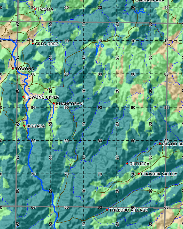
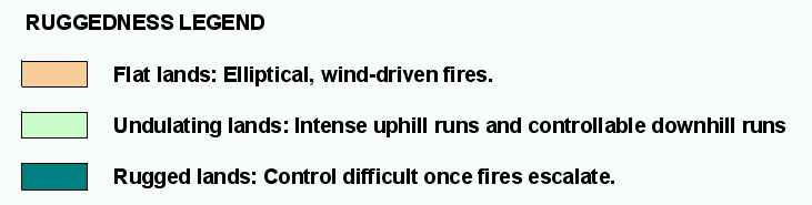
The three categories are a good indication of which type of fire behaviour to expect.
.